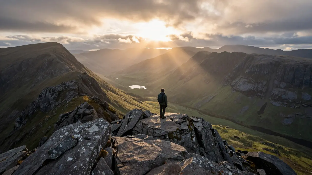
There is a specific kind of magic that happens when you stand on the summit of a Munro, defined as any mountain in Scotland with an elevation of over 3,000 feet (914.4 meters). It isn’t just about the view, though the panorama stretching from the Cairngorms to the Hebrides is breathtaking. It’s about the silence, the raw exposure to the elements, and the quiet satisfaction of checking another name off a list that has challenged walkers for over a century.
If you are looking into Munro bagging, you aren’t just signing up for a hike; you are entering a culture. With 282 peaks currently recognized by the Scottish Mountaineering Club, known for maintaining the official list of Scottish mountains and hills since 1922., the challenge is significant but entirely achievable. However, the Highlands do not care how fit you are or how expensive your boots are. Weather changes in minutes, paths vanish under peat, and navigation errors can turn a day walk into a rescue operation. This guide breaks down exactly how to approach these mountains safely and effectively, whether you are chasing your first summit or your hundredth.
Understanding the Munro List and History
To understand the obsession, you have to look back to Sir Hugh Munro. In 1891, he published a paper titled "List of the Highest Mountains and Hills in Scotland." His goal was simple: identify every peak above 3,000 feet. At the time, he listed 265 mountains. Over the last 130 years, surveying technology has improved, leading to additions and subtractions. Today, the number sits at 282.
The key thing to remember is that being a Munro is purely about height. There is no requirement for prominence (the vertical drop before reaching a higher peak), although most Munros have significant prominence. This means some Munros are massive, iconic peaks like Ben Nevis, while others are small, unassuming bumps barely visible from their neighbors. This distinction matters for planning. A "top"-a subsidiary peak below 3,000 feet connected to a Munro by a high col-is often climbed in the same outing but doesn't count toward the main tally.
| Attribute | Value / Detail |
|---|---|
| Total Munros | 282 |
| Highest Peak | Ben Nevis (1,345m / 4,413ft) |
| Lowest Munro | Buchaille Etive Beag (915m / 3,002ft) |
| Governing Body | Scottish Mountaineering Club (SMC) |
| Primary Region | Northwest Highlands & Cairngorms |
Planning Your First Ascents: Where to Start
Newcomers often make the mistake of aiming for Ben Nevis immediately. While it is the highest, it is also one of the most exposed and dangerous due to its size and weather patterns. Instead, start with accessible ranges where infrastructure exists and routes are well-defined.
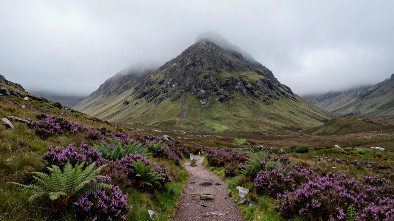
Glencoe, located in Argyll and Bute, is a fantastic starting point. The Three Sisters-Bidean nam Bian, Sgòr Deargh, and Ruaidh Stac-are challenging but offer clear paths and stunning scenery. Bidean nam Bian is the second-highest mountain in Scotland, giving you a taste of serious altitude without the logistical nightmare of remote areas.
Another excellent option is the area around Glen Coe, specifically the steep-sided valley in the Highland Council area. If you prefer something less dramatic initially, the Cairngorms offer several Munros reachable via roadheads close to the summits. Cairn Toul and Braeriach are high, but the terrain is generally gentler than the jagged granite of the Northwest Highlands.
When planning, consider the "bagging" strategy. Do you want to tackle them region by region? Or chase the highest ones first? Most baggers adopt a regional approach, renting a car and staying in base camps like Fort William, Aviemore, or Ullapool. This minimizes driving time and maximizes walking hours.
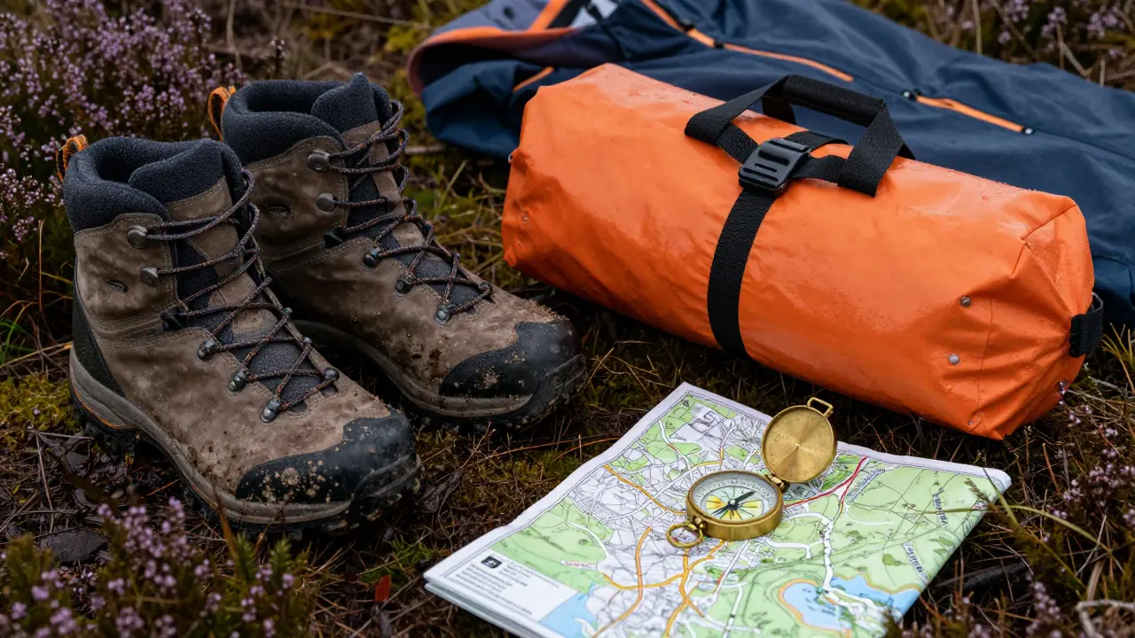
Essential Gear for Scottish Conditions
Your gear needs to be robust. The idea that you can wear trail runners and a t-shirt is a recipe for hypothermia. The Scottish weather is notoriously volatile. You might start in sunshine and end up in whiteout conditions within two hours.
- Footwear: Sturdy, waterproof hiking boots with good ankle support are non-negotiable. The ground is often boggy, rocky, and uneven. Trail runners can work for experienced navigators on dry days, but boots protect against twisted ankles on loose scree.
- Layering System: Use a moisture-wicking base layer, an insulating mid-layer (fleece or down), and a waterproof/windproof outer shell. Avoid cotton-it retains moisture and kills body heat.
- Navigation Tools: A physical map (OS Landranger or Explorer series) and a compass are mandatory. GPS devices and phone apps are great backups, but batteries die in the cold, and screens become unreadable in bright glare or heavy rain.
- Emergency Kit: Include a whistle, headtorch with spare batteries, a first-aid kit, extra food, and a emergency bivvy bag. These items weigh little but can save your life if you are stranded overnight.
Safety First: Navigating the Risks
Safety in the Highlands comes down to preparation and respect for the environment. The primary risks are falls, exposure (hypothermia/hyperthermia), and getting lost.
Falls are the leading cause of serious injury. Many Munros involve steep sections of scree or rock. Learn how to move carefully on unstable ground. Keep your center of gravity low, take smaller steps, and ensure three points of contact when scrambling.
Exposure is equally dangerous. Hypothermia can set in even in summer if you get wet and windy. Watch for the signs: shivering, confusion, slurred speech, and fatigue. If you feel these symptoms, stop, put on dry layers, eat high-energy food, and seek shelter. Hyperthermia is rare but possible in direct sun during July and August, so carry water and wear a hat.
Getting lost is common because landmarks disappear in mist. Always check the forecast before heading out. Resources like Mountain-Forecast.com provide detailed wind, cloud, and temperature data for specific peaks. If visibility drops below 500 meters, turn back unless you are highly proficient in map and compass navigation.
Leave No Trace: Protecting the Highlands
The beauty of the Munros is fragile. Peat bogs take centuries to form and are easily damaged by trampling. Stick to established paths wherever possible. When crossing open moorland, spread out to avoid creating new trails that erode the vegetation.
Take all litter home, including biodegradable items like fruit peels. They attract animals and disrupt the ecosystem. Camp responsibly-if you wild camp, choose locations away from water sources and livestock fields, and minimize fire impact. In many areas, fires are prohibited due to wildfire risk, especially in dry summers.
Respect local farmers and landowners. Gates should be left as you find them. Livestock, particularly sheep and cattle, may roam freely. Give them space, and keep dogs under strict control. Dogs can harass wildlife and livestock, leading to conflicts with locals.
Logistics: Accommodation and Transport
Most Munros require self-sufficiency. Public transport is limited in the Highlands. Renting a car is almost essential for flexibility. Allow plenty of time for travel; distances are deceptive. A 30-mile drive can take an hour due to narrow, winding roads.
Accommodation options range from hostels and B&Bs in towns like Pitlochry or Fort William to remote bothies (basic shelters). Bothies are free but require booking through the Bothy Management Association and must be left clean. For luxury, consider glamping sites near popular ranges, but be prepared to commute to the trailheads.
Timing is crucial. Summer months (June to August) offer the longest days and mildest weather, but also the most crowds. Shoulder seasons (May and September) provide fewer people but shorter days and more unpredictable weather. Winter Munro bagging is a specialized skill requiring crampons, ice axes, and avalanche awareness.
How long does it take to complete all 282 Munros?
The average time varies widely. Dedicated baggers might complete them in 3-5 years, visiting multiple times per year. Casual hikers often take 10+ years. The record is under two weeks, but this requires extreme fitness and favorable weather windows. Most people enjoy the process over many years, treating each trip as a holiday.
Do I need a guide for Munro bagging?
Not necessarily, but it helps for beginners. A guide can teach navigation, safety protocols, and route-finding skills. For technical peaks like those in the Cuillin range on Skye, professional guidance is recommended if you lack mountaineering experience. For standard Munros, thorough preparation and reliable maps are usually sufficient.
What is the best time of year to climb Munros?
July and August offer the warmest temperatures and longest daylight hours, making navigation easier. However, this is also the busiest season. May and September are good alternatives with fewer crowds, though weather is less predictable. Winter climbing (December to March) requires advanced skills and equipment.
Are there any fees to climb Munros?
No, access to most Munros is free under the Scottish Outdoor Access Code. However, parking fees may apply at popular trailheads, and accommodation costs vary. Supporting local businesses and maintaining facilities through donations is encouraged.
Can I climb Munros with my dog?
Yes, but keep your dog under strict control. Some areas have restrictions due to nesting birds or livestock. Ensure your dog is fit for long hikes and bring extra water. Remember that not all other hikers are comfortable with dogs, so be courteous and reactive to feedback.
Comments (10)
-
Keith Barker July 6, 2026
the silence up there is heavy not just because of the air but because you are alone with your own thoughts in a way that feels ancient it makes you realize how small your problems are when compared to the indifference of stone and wind

-
Lisa Puster July 7, 2026
you americans think you can just drive up and bag these peaks like they are some tourist attraction its disrespectful to the culture and history of scotland you have no idea what you are getting into and probably lack the basic respect for the land that locals have had for centuries stop treating our mountains like a checklist for your ego

-
Joe Walters July 7, 2026
oh please dont be such a snob about it i went last year and sure my knees hurt for three days after but the view was totally worth it and yeah maybe i took a selfie or two but that doesnt mean i didnt appreciate the majesty of the place so chill out before you get yourself stuck on a peak without proper gear which by the way i had plenty of unlike some people who talk big but cant even tie their laces properly

-
Robert Barakat July 7, 2026
there is a certain melancholy in the pursuit of height as if we are trying to escape the gravity of our daily lives only to find that the higher we go the more exposed we become to the elements and to ourselves

-
Michael Richards July 8, 2026
listen here most of you are walking around blindfolded relying on phone apps that die in the cold you need to learn map and compass navigation before you step foot on those trails hypothermia does not care about your fitness level or your expensive boots it kills people who think they know better than the weather check mountain forecast every single time do not be stupid

-
Laura Davis July 9, 2026
i love this guide so much thank you for sharing all these tips i am planning my first trip soon and i feel so excited but also a little nervous about the navigation part i will definitely make sure to pack the emergency bivvy bag and extra food like you suggested safety is super important and i want to enjoy the experience without any scary moments lets do this together everyone!

-
Lisa Nally July 11, 2026
actually from a technical standpoint the distinction between a munro and a corbett is crucial for route planning because the prominence requirements affect the difficulty of the descent significantly many amateurs overlook this nuance leading to inefficient itineraries and increased exposure time on the ridges which statistically correlates with higher incident rates according to the mountaineering council of scotland data from the last decade

-
Edward Gilbreath July 13, 2026
they keep changing the list because the surveyors are lying about the heights to sell more maps or something the government wants to control access to the highlands anyway so they add and remove peaks whenever they feel like it trust me i have been hiking there for years and i know things are not what they seem the official list is just propaganda for the elite climbers

-
kimberly de Bruin July 15, 2026
perhaps the true summit is not the physical peak but the moment of clarity that arrives when the fog lifts and you see the world spread out below you like a map of possibilities

-
Edward Nigma July 17, 2026
everyone says glencoe is the best starting point but thats actually terrible advice because the crowds are insane and you spend half your time waiting for parking spots instead of hiking ben nevis might be harder but at least you get the job done faster and honestly the northwest highlands are overrated anyway the cairngorms offer better value for money and less pretentious hikers so stick to the east if you want peace and quiet
